- Solutions
- Products
- Blog
- Resources
- Partners
- About
- Contact
Case Study: Safer Flood Zones and Streamlined Processes
Western Systems created a custom solution to help Washington County better manage a dangerous flood zone
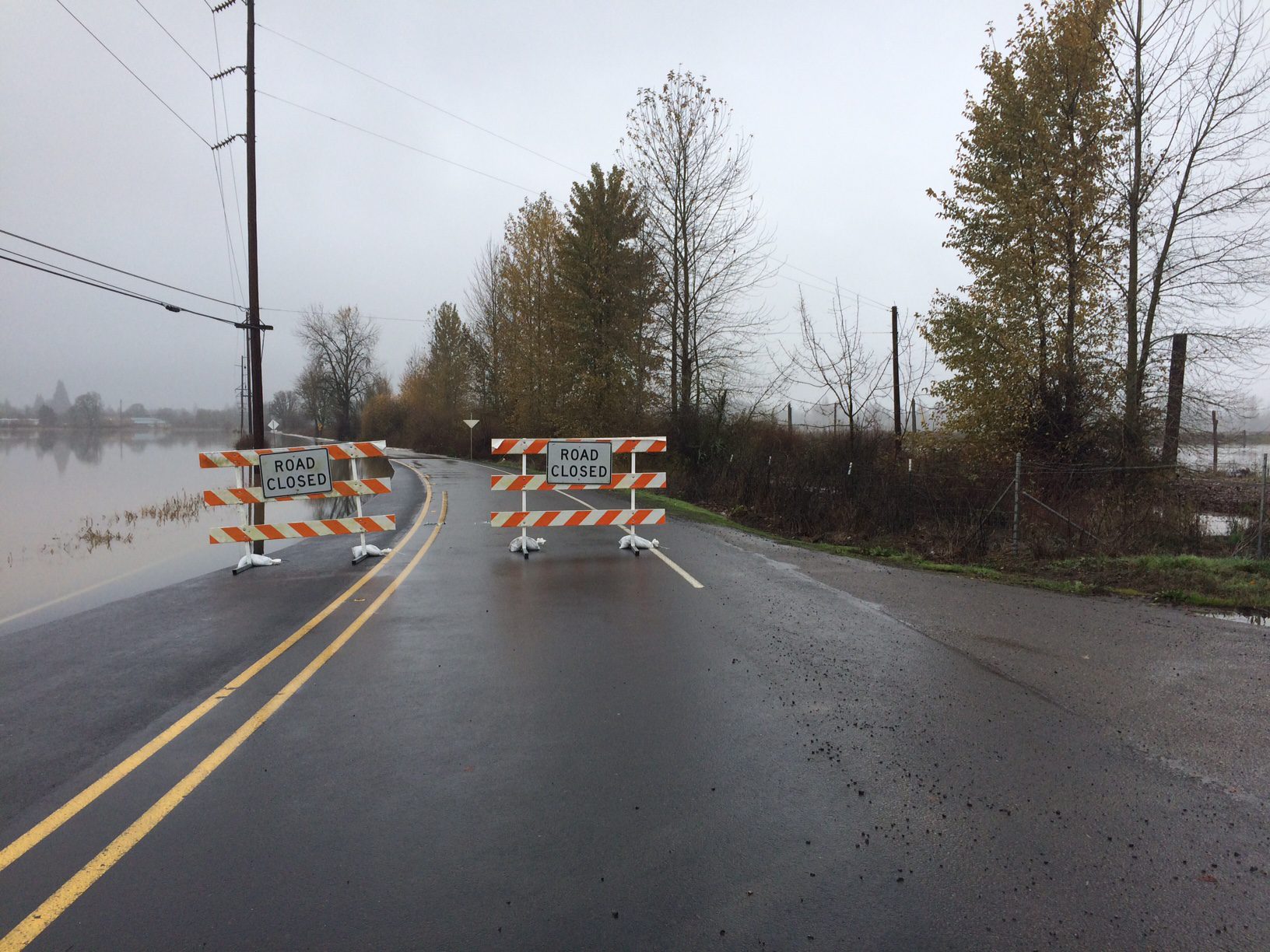
Background: Flood Zones Endangering Drivers
A low-lying stretch of road along the Fernhill Wetlands—just south of Forest Grove, Oregon—is a picturesque drive in good weather, but prone to flooding after heavy rains. This section of roadway regularly floods three to four times each year, and the nearby pond makes conditions even more dangerous when flooding occurs. Over the past years, there have been multiple high-water rescues performed due to drivers going around closure barricades.
The Challenge: Streamline Closure and Reopening Processes
Previously, during the rainy season, agency staff would stage barricades and monitor an upstream water gauge to try and determine when to dispatch a crew. The crew would then have to drive out to the site to check the roadway. If it was flooded, they would barricade and close the road, but they frequently arrived too early. In those cases, when the road was not flooded, no action would be taken and staff would need to continue to monitor conditions.
This led to multiple dispatches during almost every heavy rain, which was an incredible drain on the agency’s resources. Further, the process for reopening the road worked the same way, which required more time and resources.
Washington County needed to streamline the process by removing the guesswork. The road operations team needed to know when to dispatch a crew to close the road and when to dispatch a crew to reopen it—without wasted trips.
The Solution: A Familiar Interface on a Custom Solution
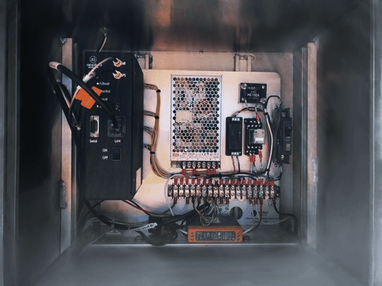
Washington County was already using Applied Information’s Glance Smart City Supervisory System™ for school zone flashers, so Western Systems worked with Applied Information to create a custom solution that could be monitored from the same platform.
The new solution uses an EchoPod water level sensor, a Siqura Camera, a gate status sensor, and relays for activating flashing lights on the gates. The system continuously monitors water depth against the threshold that the agency defined, while the cameras provide for visual remote monitoring of the roadway. The beacons were wired to activate automatically when the gate is locked.
Outcome: Greater Efficiency, Better Data, Improved Trust
The system has helped Washington County road crews dramatically streamline their process for closing and reopening this stretch of road. When the water depth threshold is met, the system automatically sends an email to staff, who can then remotely monitor the condition of the roadway from the camera feed. Crews are dispatched only when the road needs to be closed, and then again when the road is ready to be opened. Eliminating the need for crews to make multiple trips to the site saves the County time and money.
The improved response times from remote monitoring are also helping to build public trust, and road condition data can also be shared with ODOT’s statewide traveler information site, TripCheck, for public use.
The floodgate solution is just one of several unique, custom projects that Western Systems has built for Washington County. Learn how our solutions experts and engineers helped the Washington County team improve safety and increase efficiencies in school zones and snow zones across northwest Oregon as well.
If you have any Questions at all, Call us at 425.438.1133 or Contact Us